Economical Facts:
Many people work in health care and finance in Walla Walla. Industries include
food-processors, machinery and irrigation manufacturers.
Recreational Facts:
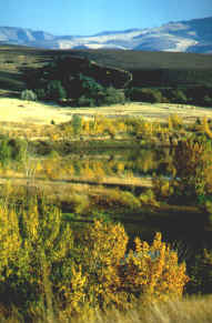
There are many outdoor activites to do in Walla Walla. They are camping,
hiking, mountain-biking, fishing, snowmobiling, snow skiing, or golfing.
Interesting facts:
Walla Walla is said to be in the North West's "Banana Belt" because of of
the mild winters and long summers. Walla Walla is also famous for the Walla Walla
Sweet Onions. Walla Walla has 3 Colleges: Walla Walla College, Walla Walla Community
College, and Whitman College.
Web Sites for More information:
home.bmi.net/wwchamber
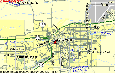
www.bigjohn.bmi.net/andringr/walla2_map.html
www.whitman.edu
Reasearch was done by Camie B. Creation of
this page was done by
Coulee City 5th Grade Web Page Creations
All of the information for this site was found from the websites above.

Click here to go back to the main page
|